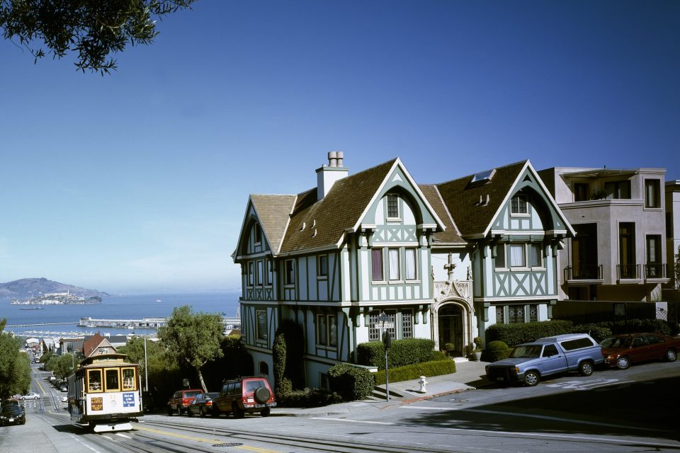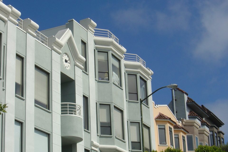

San Francisco’s neighborhoods do not behave like separate exhibits. Their edges overlap, commercial streets continue across district names, and the feeling of a place can change within a few blocks because of grade, wind, architecture, or the presence of a park. Muni is useful not only because it moves people. Its routes reveal those transitions at street level.
The most satisfying plan usually follows one transit spine and explores sideways on foot. That keeps transfers manageable, allows time for unplanned stops, and gives each neighborhood enough context. Always check current route, service, fare, and accessibility information directly with SFMTA before travel; this guide deliberately avoids schedules and prices that can change.

Painted Ladies San Francisco City Tour
Come jump on a city tour with us to cruise through some of the 15 top city highlights including Union Square, Chinatown, North Beach, Hayes Valley, Go...
Think in connected pairs, not a citywide sweep
Start with two adjacent areas that offer a meaningful contrast. Pair a dense commercial corridor with an open landscape, an older hill district with the waterfront below, or a cultural district with a nearby civic space. Avoid building a day from districts at opposite corners of the city unless the ride between them is itself part of the experience.
Useful geographic pairings include:
- the Ferry Building and Embarcadero with Chinatown or North Beach;
- the Castro with the Mission and a community-defined cultural corridor;
- Golden Gate Park with the Inner or Outer Sunset;
- the Presidio with the Richmond District or Lands End;
- Dogpatch with the Central Waterfront and nearby public open space;
- Civic Center with Hayes Valley or the lower portion of a nearby hill corridor.
These are planning relationships, not fixed itineraries. Choose a pair based on current access, the group’s interests, and the kind of terrain everyone can comfortably navigate.
Use transit as the long line and walking as the close view
Muni includes buses, Metro light rail, historic streetcars, and cable cars. Each mode has a different role, and not every line or stop offers the same accessibility. The official trip planner and access guides should make the final routing decisions.
A calm process is to locate the main transit corridor first, then identify two short walking loops near it. Save an option that removes one loop if energy, weather, or service conditions change. The walking portions should reveal details that are hard to understand from a vehicle: window projections, small businesses, public art with attribution, a park entrance, a stairway viewed from below, or a sudden cross-street glimpse of water.
Do not assume that “three blocks away” means an easy walk. Check contour, stairs, crossings, and the accessible entrance to the destination. A longer route around a hill can be more comfortable than the direct line over it.
Transit note: Cable cars are part of the public transit system and a significant piece of working heritage. Ride them with the same awareness you would bring to any shared service: allow boarding space, follow operator instructions, and avoid turning active stops into photo sets.
Northeast: hills meeting the bay
The northeast offers some of the city’s most dramatic compression and release. Chinatown’s dense streets and alleys, North Beach’s mixed commercial and residential blocks, Russian Hill’s grades, and the Embarcadero’s open horizon sit close enough to read as connected layers, even though the slopes can make that proximity demanding.
Choose one neighborhood as the center of the visit rather than treating all of them as a single sightseeing zone. In Chinatown, look for community institutions, markets, family businesses, gathering spaces, and contemporary life alongside historic interpretation. In North Beach, pay attention to the relationship among cafés, bookstores, residential streets, and the hill. On the waterfront, notice how ferry movement, piers, seawall infrastructure, and civic architecture change the scale.
If mobility or fatigue makes the hill impractical, keep the route along a gentler corridor and let transit handle the grade. The view will still change as the street opens toward the bay.

San Francisco Excursion: Guided Tour to Muir Woods and Sausalito
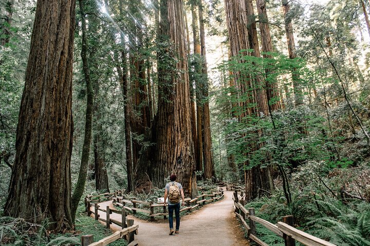
Experience the awe and wonder of one of California's oldest redwood groves as you stroll through dedicated paths o...
San Francisco, Muir Woods, Sausalito and Optional Alcatraz Tour
Discover San Francisco, Muir Woods, and Sausalito with the option to add tickets to Alcatraz! Join a small group to...

San Francisco to Muir Woods Shuttle
We are the only company in San Francisco offering a round-trip, direct shuttle from San Francisco to the majestic Re...
Central neighborhoods: culture, commerce, and civic space
The center of the city contains districts with distinct community histories and active cultural organizations. The Mission, Castro, SoMa Pilipinas, American Indian Cultural District, and nearby civic areas should not be merged into a generic “colorful neighborhoods” loop. Each has its own geography, priorities, institutions, and forms of public life.
Choose one district and begin with a source produced by the community or the city’s Cultural Districts Program. Then build the visit around a main commercial street, one cultural or public institution, and a place to pause. Public art should be read with its artist and setting, not extracted as a decorative backdrop.
Transit can make the connection between adjacent districts easy to imagine, but do not overfill the day. A market stop, mural walk, museum, meal, and evening venue may all compete for attention. Select what creates a coherent story and confirm current information directly with each place.
West: park, avenues, and ocean air
Golden Gate Park forms a long green connector through the western city. North and south of it, the Richmond and Sunset districts offer commercial streets, residential avenues, cultural institutions, and a lower, more horizontal building rhythm than the central hills. Farther west, the grid meets Ocean Beach and the Pacific.
This part of the city makes microclimates especially visible. A sheltered block can feel different from an exposed beach or overlook. Carry a layer and keep the route flexible. A foggy coast does not cancel the neighborhood: it shifts attention toward bookstores, bakeries, restaurants, architectural details, and the measured repetition of avenues approaching the water.
Use the park as more than a crossing. Its paths, gardens, museums, recreation spaces, and changing canopy can provide the open middle or endpoint of the day. Check the managing organizations for current access rather than assuming every path or facility is available.
North and northwest: Presidio layers and the wild edge
The Presidio combines historic structures, restored habitat, public landscapes, trails, and views of the bay and Golden Gate. Tunnel Tops reconnects the Main Post area with the Crissy Field waterfront over tunneled roadway infrastructure. Farther west, Lands End brings trails, cypress, rocky coast, historic remnants, and the Sutro landscape together.
These places can be geographically close yet require different levels of exertion. Choose between a civic park experience, a waterfront segment, and a coastal trail based on the group. Confirm surface, grade, closures, and accessible routes with the Presidio or National Park Service.
For a fuller western-edge plan, use From the Presidio to Lands End and Ocean Beach. It explains why those landscapes should be connected by theme rather than hurried through as one checklist.
Southeast: production, waterfront, and change
The southeastern city offers a different scale from the older north and central hills. Dogpatch and the Central Waterfront retain traces of production, distribution, repair, shipbuilding, and industrial land use alongside housing, arts spaces, parks, and new development. Farther south, Bayview and India Basin include significant African American cultural history, community institutions, working landscapes, and evolving public waterfront spaces.
Visit with the same care applied to any living district. Do not frame industrial remnants or redevelopment as if no community existed before a new park or restaurant arrived. Use local cultural organizations and city planning context to understand what is being preserved, changed, or contested. Support established businesses and respect working entrances.
Still comparing San Francisco Neighborhoods By Transit And On Foot?
Ask for tour ideas, hotel suggestions, or a simple trip plan that combines both.
Trip Helper
Make an accessible version from the beginning
Accessibility is not a last-minute substitute route. Build it into the first plan. SFMTA publishes guidance for buses, Metro, historic streetcars, stops, and mobility devices. Individual parks and venues publish their own access information. Use both.
Before committing to a neighborhood pair:
- Check the accessible transit path in both directions.
- Confirm the correct entrance, not only the street address.
- Identify grades, stairs, unpaved segments, and exposed weather.
- Choose a real pause point.
- Save a shorter route that retains the neighborhood’s main character.
A route can be rich without being long. One commercial corridor, one contextual stop, and one open view may communicate more than a full day of transfers.
Finish with what changed
At the end of a neighborhood day, ask what the route revealed. Did close façades open into bay? Did park canopy give way to ocean sky? Did a transit line connect community institutions that a landmark map would separate? Did fog shift your attention from distant scenery to material detail?

Yosemite Day Tour from San Francisco
Yosemite National Park is a must-visit California gem, and this day trip from San Francisco makes it easy. Leave the...

Alcatraz Inside Access Ferry and Audio Tour with Night Option
Explore Alcatraz Island like never before with this exclusive package that includes official admission and round-tri...

Muir Woods and Sausalito Small Group Tour
This tour will visit Muir Woods and Sausalito. Note that this tour includes the Muir Woods entrance fee. We provide...
Painted Ladies San Francisco City Tour
Come jump on a city tour with us to cruise through some of the 15 top city highlights including Union Square, Chinatown, North Beach, Hayes Valley, Go...

Small Group Yosemite and Giant Sequoias Day Trip from San Francisco
Take a day trip from San Francisco to Yosemite National Park, described as the crown jewel of the country's many s...

Golden Gate Bridge Muir Woods Sausalito with Optional Alcatraz
All of our tour guides are Bay Area Natives, which will help you understand what it’s like to grow up in SF and no...

San Francisco Love Tour
For an unforgettable City Sightseeing tour, hitch a ride in a 1970's VW Hippie bus. This is an authentic and unique...
That reflection helps choose the next route. Explore the full Guides index, use San Francisco From Hill to Horizon for a broader planning framework, or browse Tours when guided local interpretation would make the connection more meaningful. The goal is not to complete a neighborhood collection. It is to understand how the city changes as you move through it.