San Francisco’s western edge is not one continuous scenic trail. It is a sequence of distinct landscapes: the Presidio’s historic structures and restored public spaces, bluffs and bay shoreline, the cypress and rocky coast of Lands End, the ruins of Sutro Baths, and the broad Pacific horizon at Ocean Beach. They belong in the same story, but not necessarily in the same day’s walk.
Choose the segment that fits your group, then let its layers become the experience. Confirm current trail, access, transit, weather, and safety information with the Presidio and National Park Service before leaving. Coastal conditions and temporary closures can change.

Vantigo - The Original San Francisco VW Bus Tour
Looking for an authentic San Francisco experience? Trade the tour bus for a vintage Volkswagen van that easily navigates the city’s less-traveled la...
The Presidio: inherited ground, adapted again
The Presidio contains Indigenous, Spanish, Mexican, United States military, and national-park histories. Its buildings, planted landscapes, archaeological resources, fortifications, and habitat cannot be reduced to a bridge viewpoint. Good interpretation should acknowledge that military reuse and public park transformation occur on land with deeper histories and continuing Indigenous relationships.
Presidio Tunnel Tops offers a clear contemporary example of infrastructure being reworked into public landscape. Parkland built over roadway tunnels reconnects the Main Post area with the Crissy Field waterfront. Paths, overlooks, lawns, gathering areas, and planted slopes turn what was once a barrier into a crossing.
Walk with that transformation in mind. Notice where the land bridges over traffic, where views are deliberately framed, and where historic buildings meet contemporary public space. If your day needs a lower-intensity outdoor segment, official maps can help identify accessible approaches and amenities. Verify them for the exact route rather than assuming the entire park has the same surface or grade.

Crissy Field: bay scale and working weather
The bay side of the Presidio offers a wider, flatter visual field than the forested ridges and Pacific cliffs farther west. The Golden Gate Bridge may dominate the horizon in clear conditions, but the foreground matters: shoreline habitat, wind, people moving through public space, and the relationship between historic airfield land and present-day recreation.
Visibility can change quickly. International Orange was selected in part for the bridge’s relationship to hills, ocean, and sky, and the color behaves differently in clear sun, bright overcast, and fog. Rather than chasing a single perfect postcard, look at how structure appears and disappears across layers of air.
Keep wildlife and habitat areas undisturbed, follow posted boundaries, and use designated paths. A waterfront promenade is still an exposed marine environment, so plan for wind and cooler air even if the starting neighborhood feels sheltered.
Lands End: city at a rocky continent edge
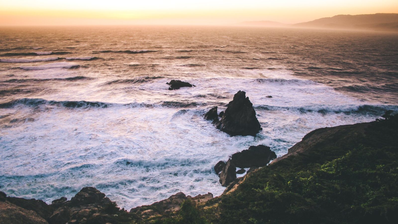
At Lands End, trails move through cypress and eucalyptus and open toward rocky shoreline, the Golden Gate, and the Pacific. The landscape also contains remnants of earlier transportation, recreation, and military uses. Former rail grades, concrete gun mounts, road traces, building pads, and the Sutro landscape complicate the idea of an untouched coast.
This layering is the reason to move slowly. A weathered block of concrete may be part of a former battery. A path alignment may follow an older route. Trees that now define the silhouette reflect past landscape change. Read signs and official interpretation rather than inventing a story from a ruin.
The coastal setting requires care. Remain on designated trails, keep back from cliff edges, and follow current National Park Service guidance. Fog can reduce visibility, and wind or wet surfaces may change what feels comfortable. If the main overlook is obscured, the near field, vegetation, rock, infrastructure, and sound, still carries the place.
Sutro Baths: ruins of public recreation
The visible concrete pools at Sutro Baths are remnants of a large public bathhouse developed by Adolph Sutro in the late nineteenth century. The complex combined swimming pools with other attractions and became reachable through expanded transportation to Lands End. Its scale and later disappearance are easier to understand when viewed as part of a larger recreation landscape that included the Cliff House and Sutro Heights.
Avoid treating the ruins as a free-climbing structure or a mysterious ancient site. They belong to a documented modern history and sit within an active coastal environment. View them from permitted areas, use the National Park Service’s interpretation, and keep the ocean’s force in mind.

San Francisco Love Tour
For an unforgettable City Sightseeing tour, hitch a ride in a 1970's VW Hippie bus. This is an authentic and unique...

Muir Woods and Sausalito Tour (Return by Bus or Ferry)
Take time out from San Francisco on a half-day trip to Muir Woods National Park and Sausalito. This enthralling ha...

San Francisco Excursion: Guided Tour to Muir Woods and Sausalito
Experience the awe and wonder of one of California's oldest redwood groves as you stroll through dedicated paths o...
Ocean Beach: where the grid reaches open water
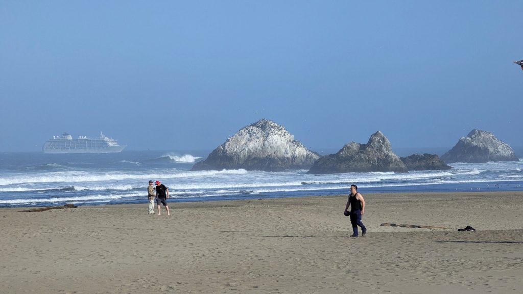
Ocean Beach changes the composition again. The city’s avenues approach a broad, flat horizon, with dunes and exposed sand between the urban grid and Pacific water. The scene can feel spacious after Lands End’s framed trail views and the Presidio’s layered slopes.
Treat the beach as an ocean environment, not a guaranteed swimming destination. Follow official warnings and posted conditions, keep a safe distance from hazardous water, and do not assume that a calm-looking surface is safe. Wind, sand, and marine air may also make a short visit more suitable than a long stay.
The adjacent Outer Sunset adds useful context. Repeating façades, neighborhood commercial streets, and lower building forms create a transition rather than an abrupt return to the city. A coastal day can end with that everyday urban scale instead of another distant landmark.
Choose one of three coherent plans
These frameworks avoid promising a particular schedule or level of access. Verify every segment before use.
Public landscape and bay
Focus on the Presidio’s Main Post area, Tunnel Tops, and a suitable part of the Crissy Field waterfront. This route foregrounds adaptive infrastructure, gathering space, historic structures, and bay views. It can be shortened without losing its central story.
Coastal trail and historic remnants
Build around Lands End and the Sutro landscape. Choose trail segments based on current conditions, grade, and mobility needs. The key relationship is between coastal ecology, recreation history, former military use, and the Pacific edge.
Park-to-ocean transition
Approach Ocean Beach through Golden Gate Park or the Outer Sunset, using verified transit and accessible routes. Notice how tree canopy or neighborhood grid opens into dunes, wind, and horizon. The transition is the subject, not simply the arrival photograph.
Trying to combine all three can create more transit and walking than context. If time and energy are limited, select one and save the next for another day.
Prepare for the conditions you actually have
Before setting out:
- check the official forecast and current park notices;
- confirm transit in both directions, including the accessible path if needed;
- identify trail surface, stairs, grade, and exposed sections;
- carry a layer suitable for wind and shifting marine air;
- bring water and avoid relying on an unverified concession or facility;
- choose a sheltered or indoor counterpart nearby;
- tell someone the route if the group plans a longer coastal walk.
Keep the plan flexible enough to turn back. A route does not become better because it reaches every viewpoint.
Photograph a real coast
Use foreground to distinguish this coastline from generic California imagery. Cypress, coastal scrub, rock, weathered concrete, rail or battery remnants, dunes, and the city’s street grid all establish location. Preserve fog when it is present rather than replacing it with saturated blue sky. Do not fabricate signage, remove safety barriers from documentary images, or imply access from a viewpoint where visitors should not stand.
People can appear as trail users, families in public landscapes, park stewards, or residents moving through the waterfront, with consent and context where appropriate. Avoid turning solitary figures into symbols of danger or romantic isolation.
Return to the city with the edge still visible
The western landscape explains something central about San Francisco: urban density and wild-seeming exposure occupy the same small peninsula. The most memorable shift may be the moment cypress opens toward water, a ruined wall frames surf, or a numbered avenue reaches the sky.

SF: Hop-on Hop-off Sightseeing Tour by Open-top Bus
See San Francisco’s top sights the easy way with Big Bus Tours. We offer the most comprehensive tour with over 17...
San Francisco Excursion: Guided Tour to Muir Woods and Sausalito
Experience the awe and wonder of one of California's oldest redwood groves as you stroll through dedicated paths o...
Vantigo - The Original San Francisco VW Bus Tour
Looking for an authentic San Francisco experience? Trade the tour bus for a vintage Volkswagen van that easily navig...
Vantigo - The Original San Francisco VW Bus Tour
Looking for an authentic San Francisco experience? Trade the tour bus for a vintage Volkswagen van that easily navigates the city’s less-traveled la...

Small-Group Wine Country Tour from San Francisco with Tastings
Beautiful Sonoma Valley is your destination on this laid-back, fun-filled, all-day tour. You will learn much about t...

San Francisco: Golden Gate Bay Cruise (60 Minutes)
One hour scenic voyage - Ferry between Pier 43.5 and Fisherman’s Wharf while transiting along San Francisco’s br...

Monterey, Carmel and 17-Mile Drive: Full Day Tour from SF
Cruise along California's spectacular coastline on a relaxing day trip from San Francisco. Follow Highway 1 and enjo...
For a citywide framework, return to San Francisco From Hill to Horizon. For transit-linked neighborhood planning, read San Francisco Neighborhoods by Muni and on Foot. The coast should not be a detachable backdrop. It is one of the forces that shapes the city’s weather, movement, materials, and sense of reveal.