San Francisco makes the most sense when you stop treating it as a checklist of isolated landmarks. The city is compact on a map, yet every ridge, transit line, and band of fog changes how the next few blocks feel. A street can begin among downtown towers, climb past bay windows and corner shops, and end with a strip of blue water framed between buildings. A route near the Pacific can feel cool and wind-shaped while a sheltered neighborhood to the east catches brighter light. The useful question is not simply, “What can I fit in?” It is, “Which connected piece of the city can I understand today?”
This guide offers a framework rather than a timed itinerary. It joins neighborhood life, public transit, architecture, open space, and the natural edge without pretending that every traveler moves at the same pace. Use it to build one coherent day, then leave room for the city to interrupt your plan. Check official transit, park, and venue information before setting out, because service conditions, access, and public programs can change.

North Beach & Little Italy Walking Tour: Food, History & Flavor
Definitely one for the food lovers, the Little Italy and North Beach Walking Tour is a glimpse into the blend of culture and cuisine of San Francisco...

Begin with the city’s three edges
San Francisco sits between the Pacific Ocean, the Golden Gate, and the bay. Those waters do more than define the city limits. They shape wind, light, temperature, and the direction of views. The west looks toward the open Pacific, often through dunes, coastal scrub, or moving marine air. The north turns toward the strait and headlands. The east meets a working and civic waterfront where ferries, piers, market spaces, and dense neighborhoods face the bay.
You do not need to visit all three edges in one day. In fact, trying to do so can turn a place-based visit into a sequence of transfers. Choose one edge as your destination and let the route toward it provide the rest of the day. A westward day might move from a neighborhood commercial street to Golden Gate Park and then the ocean. A northern route might connect the Presidio’s layered landscapes with Lands End. An eastern route might pair the Ferry Building and Embarcadero with Chinatown, North Beach, or a hill above the waterfront.
That decision gives the day a simple shape:
- Start within a neighborhood, at the scale of storefronts, sidewalks, and daily errands.
- Follow one transit or walking spine rather than jumping between unrelated districts.
- Let a park, overlook, waterfront, or coastal trail provide the spatial release.
- Return through a different but adjacent neighborhood if energy and conditions allow.
The same structure works for a first visit and a return trip. Only the chosen spine changes.
Read the weather as part of the map
San Francisco’s hills and maritime setting produce real microclimates. The western side can hold cool coastal air while neighborhoods farther east feel clearer or warmer. Fog may soften the skyline, erase a distant view, or move through the Golden Gate while another part of the city remains bright. This is not a reason to postpone every outdoor plan. It is a reason to build flexibility into the route.
A light layer and a small day bag are more useful than dressing for a generic idea of California. Even on a bright start, exposed overlooks and waterfront paths can feel different from protected streets. If an important viewpoint is hidden, shift attention to the close city: painted steel, window reflections, sidewalk gardens, stairways, corner produce, public art in context, and the rhythm of façades along a slope.
Planning note: Treat a clear long view as a welcome reveal, not the sole measure of a successful day. Fog can make the coast, bridge structure, cypress, and street lighting more legible in different ways. Essential route decisions should still follow official safety guidance and current conditions.
The best weather backup is not a random indoor attraction across town. It is a nearby place that deepens the same story. Pair a coastal walk with a museum or historic interior in the northwest. Pair a waterfront route with a market hall or cultural institution nearby. Pair a neighborhood architecture walk with a bookstore, gallery, café, or community-run cultural space on the same corridor.

SF: Hop-on Hop-off Sightseeing Tour by Open-top Bus
See San Francisco’s top sights the easy way with Big Bus Tours. We offer the most comprehensive tour with over 17...

San Francisco to Muir Woods Shuttle
We are the only company in San Francisco offering a round-trip, direct shuttle from San Francisco to the majestic Re...

Muir Woods and Sausalito Tour (Return by Bus or Ferry)
Take time out from San Francisco on a half-day trip to Muir Woods National Park and Sausalito. This enthralling ha...
Choose one spine, then explore sideways
A transit line can act as the backbone of the day, but the memorable parts often happen a block or two away from it. Muni buses, Metro lines, historic streetcars, and cable cars serve different terrain and corridors. BART connects parts of San Francisco with the wider region but is not a substitute for understanding the city’s local network. Ferries add a regional water journey, although their destinations lie beyond the city.
Use the official SFMTA trip planner close to departure, then save the essential route details in case reception changes. Look at the shape of the route as well as the arrival estimate. A single line with a short walk at each end can be calmer than a theoretically faster chain of transfers. When walking, inspect the grade rather than assuming the most direct street is the most comfortable.
A practical decision sequence is:
- Identify the main district and one landscape destination.
- Confirm the nearest useful transit corridors.
- Check whether the walking connection includes stairs or a steep grade.
- Find an accessible alternative if anyone in the group needs it.
- Choose one optional stop, not four mandatory detours.
- Keep it on or near the same route.
- Make sure it still adds value if the long view disappears.
- Mark a natural stopping point.
- A public plaza, park bench, market hall, or calm café can reset the day.
- Do not assume every viewpoint has shelter, seating, or restrooms.
This approach creates room for observation. It also reduces the temptation to treat neighborhoods as scenic backdrops passed at speed.
Match the route to the kind of city you want to see
Different corridors reveal different relationships between urban form and landscape. The table below is a starting point, not a promise about conditions or access.
| If you want to foreground… | Build around… | Notice along the way | Useful flexible counterpart |
|---|---|---|---|
| Bay, ferries, and civic waterfront | Ferry Building and the Embarcadero | Seawall infrastructure, pier rhythm, market circulation, bay light | Chinatown, North Beach, or an indoor cultural stop nearby |
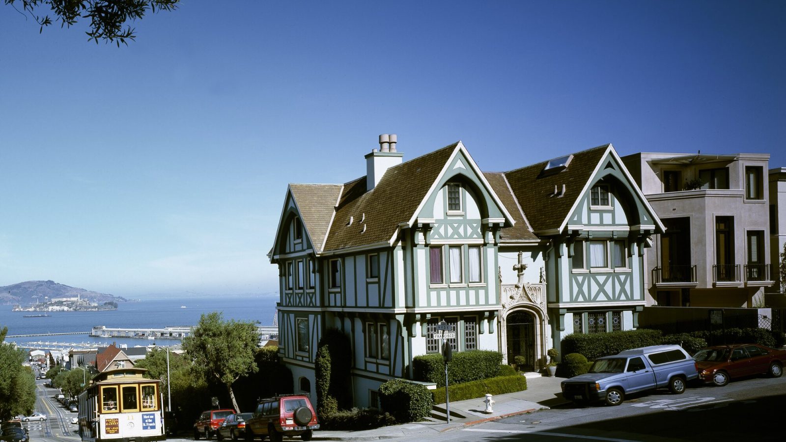
| Steep streets and engineered transit | Nob Hill, Russian Hill, and a cable-car corridor | Cable slot, grip movement, changing cross-street views, masonry bases | A quieter hilltop interior or neighborhood café |
| Park-to-ocean transition | Golden Gate Park toward the Outer Sunset | Tree canopy giving way to lower façades, dunes, wind, flat horizon | A museum, garden, or neighborhood commercial street |
| City beside wild Pacific coast | Presidio, Lands End, and Sutro landscape | Cypress, coastal scrub, weathered concrete, rocky water, layered military and recreation history | A sheltered Presidio space or Richmond District stop |
| Living cultural districts | One community-defined district and its adjacent streets | Businesses, gathering places, public art with context, language, everyday routines | A community institution or independently run shop on the same corridor |
| Working and changing southeast waterfront | Dogpatch, Central Waterfront, or India Basin context | Industrial scale, production spaces, public access points, new civic landscapes | A local arts, food, or park stop rather than a downtown pivot |
Before following any route, confirm current access and mobility information with the agency or place that manages it. A map line does not reveal construction, temporary closures, surface conditions, or the steepness of the final approach.
Still comparing San Francisco Neighborhood, Transit, And City Edge Planning?
Ask for tour ideas, hotel suggestions, or a simple trip plan that combines both.
Trip Helper
Let the hills edit the view
The hills do more than create scenic streets. They control sequence. At the bottom of a grade, the view is compressed by building fronts, parked vehicles, street trees, and overhead wires. As you climb, cross streets begin to reveal fragments of another district or body of water. At the crest, the field opens. On the descent, the horizon may disappear again behind the next block.
This makes a cross-town walk more cinematic than a direct march to a famous overlook, but it also makes distance deceptive. A short line on the map can include demanding grades. Build pauses into the route and be willing to ride around a hill rather than over it. Travelers using wheelchairs, mobility devices, strollers, or managing pain and fatigue should consult SFMTA accessibility information and the destination’s own access guidance instead of relying on generalized “walkable city” claims.
Stairways can be beautiful neighborhood connectors, but they should be treated as optional features, not universal shortcuts. The same applies to unpaved coastal paths. A route is only useful if it fits the people taking it.
Look beyond the postcard façade
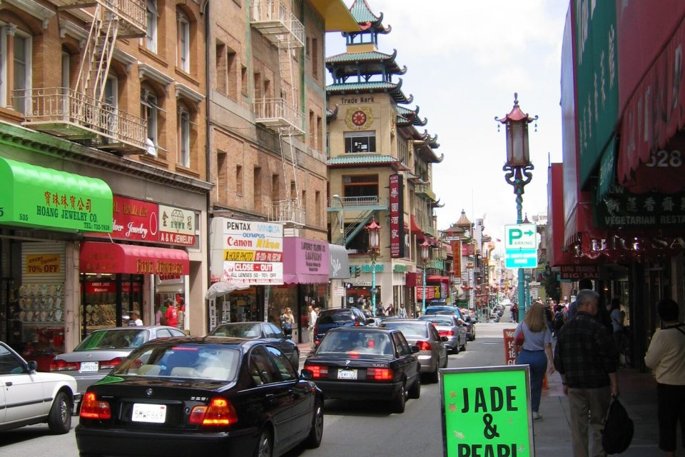
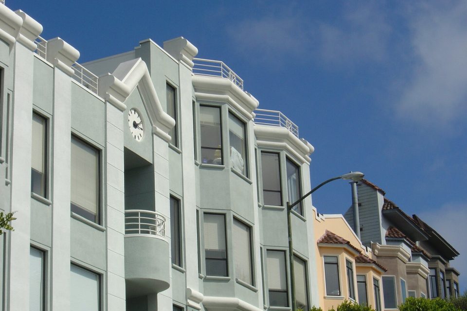
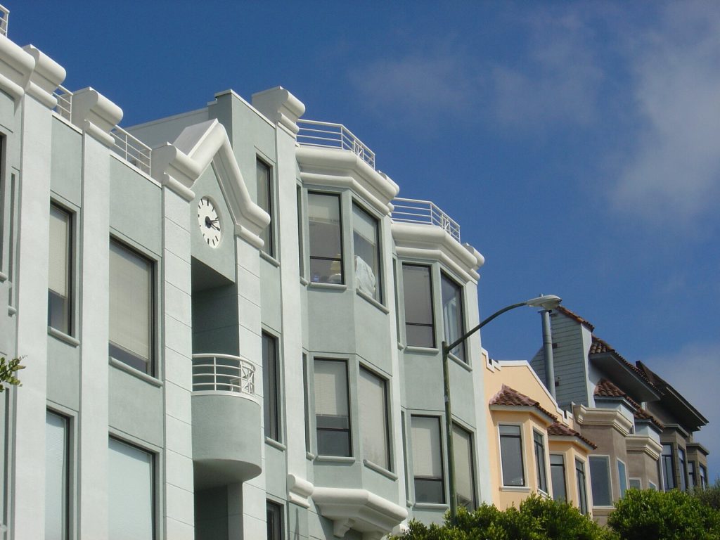
San Francisco’s architecture is often summarized with one row of ornate Victorian houses. That image is part of the city, but it is not the whole architectural story. Narrow lots, projecting bay windows, Edwardian façades, western-neighborhood stucco, civic masonry, industrial waterfront buildings, Art Deco infrastructure, modern infill, and adapted military structures all contribute to the streetscape.
Pay attention to how buildings meet the grade. Entrances rise from one end of a lot and settle near the sidewalk at the other. Garage openings, retaining walls, stairs, and bay windows negotiate limited space. Cornices and window frames catch changing light. On wider streets, repeated narrow façades create a vertical rhythm; near the water, piers and seawall structures create a longer horizontal cadence.
You can turn any neighborhood walk into an architecture study by asking four questions:
- How does the building meet the slope?
- Which elements project into the street view, and which sit in shadow?
- What material tells you something about the building’s use or period?
- How does the block change when the street opens toward water, a park, or a wider civic space?
For a dedicated route, continue with an architecture walk through San Francisco’s details. It focuses on observation rather than assigning a simplified style label to every building.
Visit cultural districts as living places
San Francisco’s Cultural Districts are not decorative themes. They are community-led place-keeping efforts connected to residents, businesses, artists, organizations, histories, and ongoing priorities. The most respectful way to visit is to learn which community defines the district, follow locally produced interpretation, and spend time with places that contribute to its present life.
That means a mural should not be reduced to a colorful background. Look for its title, artist, commissioner, and relationship to the site. A festival photograph should not stand in for everyday neighborhood life. A historic marker should prompt further reading rather than close the story. If a community organization publishes visitor guidance, a walking map, or a business directory, treat it as a primary orientation source.
Good visitor habits are simple:
- Enter businesses as a customer, not as a photographer looking for set dressing.
- Ask before making a close portrait or photographing work inside a small shop.
- Keep doorways, transit stops, and narrow sidewalks clear.
- Describe art and cultural symbols with their real attribution and context.
- Avoid claiming that one street, cuisine, or visual style represents an entire community.
- Remember that visible culture is contemporary and evolving, not frozen at the moment a guidebook first noticed it.
The guide to markets, murals, and living Cultural Districts offers a more detailed framework for planning this kind of visit.

Alcatraz Prison Tour and Golden Gate Bridge Bay Cruise
This is a unique tour package to visit both the Alcatraz Island and the Golden Gate Bridge! For the Alcatraz tour, y...

Alcatraz Inside Access Ferry and Audio Tour with Night Option
Explore Alcatraz Island like never before with this exclusive package that includes official admission and round-tri...

San Francisco Excursion: Guided Tour to Muir Woods and Sausalito
Experience the awe and wonder of one of California's oldest redwood groves as you stroll through dedicated paths o...
Use food to understand place, not to collect trophies
San Francisco’s food life reflects migration, regional agriculture, waterfront trade, neighborhood entrepreneurship, and continual experimentation. A useful food route may connect a market hall with a long-established neighborhood business, a bakery with a nearby park, or a meal with the cultural institution that provides context for the surrounding district. It does not need to chase a ranked list.
Because businesses, menus, and reservation practices change, evergreen planning starts with geography. Choose the neighborhood first. Then check current information directly with the business. Leave room for a place you notice while walking, but do not assume a small restaurant can accommodate every group or dietary need without advance confirmation.
At the Ferry Building, the architecture and transportation role are as important to the story as the food marketplace. Along neighborhood corridors, the scale is more intimate: produce displays, bakeries, restaurants, bars, bookstores, and community services share the sidewalk. The contrast between these settings helps explain how the city connects regional movement with local routines.
Make the natural edge part of the city story
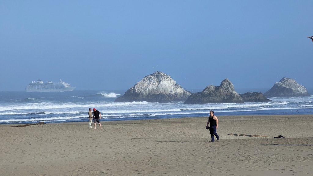
The Pacific edge does not feel like a scenic excursion pasted onto an urban trip. At Lands End, rocky cliffs, cypress, coastal scrub, military remnants, former rail grades, and the ruins of Sutro Baths occupy the same landscape. In the Presidio, historic structures and reused infrastructure sit within a national park. At Ocean Beach, the city’s street grid reaches a wide, exposed horizon.
These places deserve more than a quick photograph. Wind, surf, cliff edges, and changing visibility require attention. Stay on designated routes, respect closures, and use official guidance for coastal safety. Conditions at the water can differ sharply from a sheltered street only a few neighborhoods away.
The western edge also changes the scale of the day. After hours among narrow blocks, the open Pacific can feel unusually expansive. That contrast is central to San Francisco’s character. Read the guide from the Presidio to Lands End and Ocean Beach before choosing which part of the coast fits your group.
Build a day with compression and release
Instead of arranging a day by fame, arrange it by spatial rhythm. Begin where details are close: a neighborhood street, market, transit platform, or building interior. Move along a corridor where the city changes block by block. End the main arc at an open landscape. Then return to a comfortable, human-scale place for the final part of the day.
One adaptable framework looks like this:
Opening: a neighborhood at street level
Choose one commercial corridor or cultural district. Walk slowly enough to notice how storefronts, residences, transit, and public space share the block. If you plan to photograph people or interiors, ask first. Use local interpretation where it exists.
Middle: a connected civic or architectural stop
Continue along the same transit spine to a museum, market hall, park structure, historic transit site, or public landscape. This is the moment for deeper context and a weather-flexible pause. Avoid crossing the entire city simply because another attraction is famous.
Release: water, park, or overlook
Let the route open toward bay, strait, ocean, or a large park. Keep the endpoint flexible enough that fog or wind does not erase the purpose. The landscape should add ecological, infrastructural, or historical meaning, not just provide a selfie backdrop.
Return: a different adjacent texture
If energy allows, return through a neighboring district rather than retracing every step. A change from water to narrow streets, or from park canopy to a low-rise commercial avenue, makes the city’s contrasts legible. If the group is tired, take the simplest verified transit route back and save the extra neighborhood for another day.
This pattern can be shortened without becoming incomplete. A two-stop day with time to look is often more revealing than six rushed arrivals.
Choose a base that supports the route
Where you stay affects how the city feels before and after the main outing. Start with geography, not a generic ranking. If most of your plans cluster around western parks and the Pacific, a base that simplifies those connections may be more useful than one chosen only for a famous view. If waterfront departures or northeast neighborhoods are central, compare the transit and grade between a property and those routes. A location that looks close on a flat map may sit above a demanding hill.
Consider the immediate evening environment as well. Some travelers want restaurants and activity close by; others value a calmer residential edge. Check the actual property entrance, accessible route, noise information, and current transit rather than assuming that every room in a neighborhood has the same conditions.
When hotel results appear on Tourism SF, they must come from a verified provider response. Treat price, availability, room type, taxes, fees, cancellation terms, and accessibility as provider-controlled facts to confirm before booking. Until then, use the Where to Stay guides to compare neighborhood context without fabricated inventory.
Plan for access, rest, and changing conditions
Good planning accounts for more than distance. Note where the route becomes exposed to wind, where seating is likely but not guaranteed, and whether the path includes stairs, sand, uneven surfaces, or steep grades. Official accessibility pages are more reliable than casual descriptions, but individual needs still vary.
Before leaving, check:
- current transit alerts and the accessible route for any necessary connection;
- official park or waterfront notices;
- whether a venue requires advance entry arrangements;
- the forecast for both the starting neighborhood and the coastal endpoint;
- a nearby place to pause without needing to make a purchase;
- a shorter version of the route that preserves its main idea.
If someone needs a lower-grade day, build around level waterfront segments, park promenades, or transit-connected civic spaces and confirm the exact accessible approach. If young travelers are part of the group, prioritize room to stop and one landscape where exploration does not depend on constant quiet. If the group has different interests, choose a spine with parallel options rather than splitting across distant neighborhoods.
Keep the wider Bay Area distinct
San Francisco is part of a larger region, but nearby destinations are not interchangeable scenery. The Marin Headlands, Oakland, Berkeley, Silicon Valley, wine country, Monterey, and Big Sur each require their own planning and geographic honesty. A view across the Golden Gate may include Marin, but that does not make a Marin trail a San Francisco attraction. A BART ride may connect to the East Bay, but that is a regional journey, not another San Francisco neighborhood.
This distinction improves trip planning. It prevents accidental overloading and gives each place enough time. If you take a regional day trip, call it that and use the relevant local sources. On a San Francisco day, let the peninsula’s own transitions, from dense block to hill crest, bay edge to park, or neighborhood corridor to Pacific horizon, carry the experience.
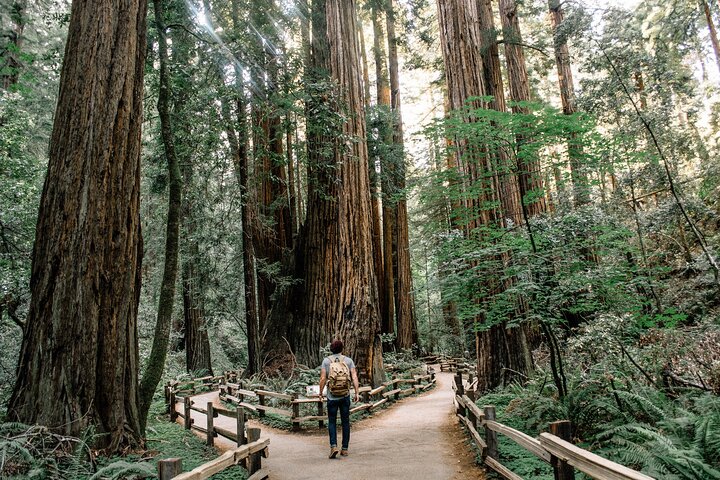
San Francisco, Muir Woods, Sausalito and Optional Alcatraz Tour
Discover San Francisco, Muir Woods, and Sausalito with the option to add tickets to Alcatraz! Join a small group to...

Yosemite Day Tour from San Francisco
Yosemite National Park is a must-visit California gem, and this day trip from San Francisco makes it easy. Leave the...

San Francisco Love Tour
For an unforgettable City Sightseeing tour, hitch a ride in a 1970's VW Hippie bus. This is an authentic and unique...
Follow what the hills reveal
The slogan is not a demand to climb every steep street. It is an invitation to notice sequence. A hill can reveal the bay, but it can also reveal the shape of a block, the practical intelligence of a transit system, the shift between microclimates, or the way one neighborhood meets the next. The city becomes more useful and more interesting when those relationships matter as much as the landmark at the end.
Start with one route. Check the current facts. Leave space between stops. Pay attention to who gives a district its life. Let the close view and the long view alternate. Then use the Guides index to choose a deeper neighborhood, architecture, culture, or outdoors story for the next day, or browse Tours if a locally guided experience would add context.

Vantigo - The Original San Francisco VW Bus Tour
Looking for an authentic San Francisco experience? Trade the tour bus for a vintage Volkswagen van that easily navig...

Muir Woods and Sausalito Small Group Tour
This tour will visit Muir Woods and Sausalito. Note that this tour includes the Muir Woods entrance fee. We provide...

San Francisco Super Saver: Muir Woods & Wine Country w/ optional Gourmet Lunch
Enjoy the best of both worlds on this award-winning tour—begin your day with a peaceful stroll through the majesti...

Painted Ladies San Francisco City Tour
Come jump on a city tour with us to cruise through some of the 15 top city highlights including Union Square, Chinatown, North Beach, Hayes Valley, Go...

Golden Gate Bridge Muir Woods Sausalito with Optional Alcatraz
All of our tour guides are Bay Area Natives, which will help you understand what it’s like to grow up in SF and no...

Small Group Yosemite and Giant Sequoias Day Trip from San Francisco
Take a day trip from San Francisco to Yosemite National Park, described as the crown jewel of the country's many s...
North Beach & Little Italy Walking Tour: Food, History & Flavor
Definitely one for the food lovers, the Little Italy and North Beach Walking Tour is a glimpse into the blend of cul...
San Francisco does not need to be solved in one visit. It rewards the traveler who can move with purpose and still be surprised by the opening at the top of the street.